Design, Education, Site Analysis Series

Climate Factors in Nigerian Architecture: Temperature, Humidity, and Precipitation

Understanding the climate of a site is fundamental for designing buildings that are both comfortable and sustainable. In Nigeria, where the climate ranges from tropical to arid, these factors are particularly important in shaping architectural designs that can stand up to local conditions. This post will explore how these climate factors particularly temperature, humidity, and precipitation can impact site analysis and design strategies for buildings across Nigeria.

Climate in Site Analysis

Climate refers to the long-term weather patterns of a particular region, including temperature, humidity, precipitation, wind, and sunlight. When analyzing a site, understanding its climate conditions is critical because it influences how buildings interact with the environment. Climate affects building materials, energy efficiency, indoor comfort, and sustainability.

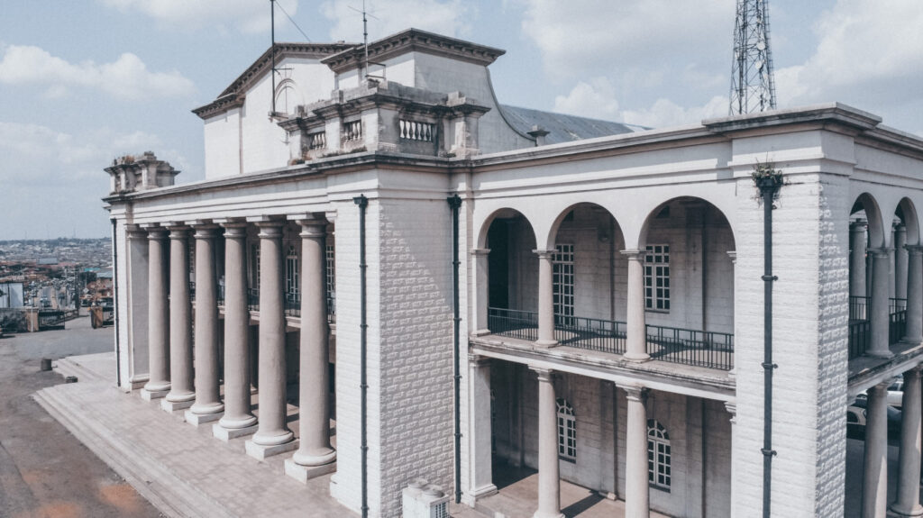
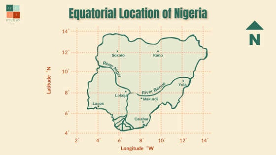
In Nigeria, there are diverse climate zones, which require specific design strategies depending on the region. For example, the coastal areas experience a humid tropical climate, while the northern regions have a dry, hot climate, and the central regions have a more temperate climate. By understanding how climate can vary across different parts of Nigeria, architects can create designs that align with local conditions and maximize comfort.

Temperature and its Role in Site Analysis

Temperature refers to the degree of heat or cold in a given area over time. Temperature plays a vital role in determining how heat is absorbed, retained, and released from a building. In Nigeria, the temperature varies greatly across regions, with higher temperatures in the north and slightly lower temperatures in the south, but it is consistently hot throughout most of the year. Here is a breakdown of the temperature patterns across Nigeria:

  • Northern Nigeria: Regions such as Kano, Kaduna, and Sokoto experience very high temperatures, particularly during the dry season. Daytime temperatures can reach 40°C or more, while nights are relatively cooler.
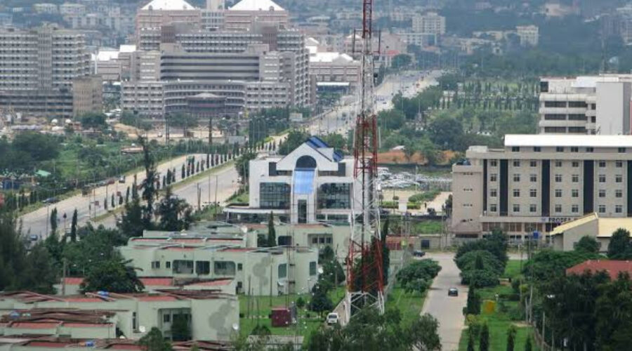
  • Central Nigeria: Areas like Jos and Abuja experience more moderate temperatures. Due to higher elevations, temperatures here are cooler compared to the rest of the country.
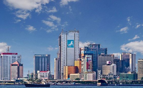
  • Southern Nigeria: Coastal regions such as Lagos and Port Harcourt are generally warm with temperatures ranging from 25°C to 30°C but with high humidity levels, which can make it feel much warmer.

How Temperature Impacts Design

Temperature can impact the design of buildings through the following factors:

  • Insulation: In hot areas, such as northern Nigeria, designing buildings with materials that provide insulation—such as double-glazed windows, thermal mass, and appropriate roofing—can help keep indoor spaces cooler.
  • Natural Ventilation: The use of natural ventilation is essential in warmer climates. Orienting buildings to take advantage of prevailing winds can reduce the need for mechanical cooling, which is both energy-efficient and sustainable.
  • Shading: Overhangs, pergolas, and strategic landscaping using trees can provide shade and reduce heat gain. In southern regions where the sun is strong, shading buildings from the afternoon sun helps maintain cooler indoor temperatures.

Humidity and its Influence on Site Design

Humidity refers to the amount of moisture in the air. In Nigeria, humidity levels are especially high in the southern and coastal regions, while the northern parts experience much lower humidity, especially during the dry season. The humidity patterns across Nigeria are as follows:

  • Coastal Areas: Lagos, Calabar, and Port Harcourt are known for high humidity, especially during the rainy season. These areas experience a tropical climate with humidity levels often exceeding 80%.
  • Northern Nigeria: In contrast, the northern regions like Sokoto and Kano experience much lower humidity, which leads to drier air, particularly during the harmattan season.
  • Central Nigeria: The middle-belt states like Jos and Abuja have moderate humidity levels due to their higher elevation.

How Humidity Affects Building Design

Humidity can affect the design of buildings through the following factors:

  • Ventilation and Airflow: Humidity can make outdoor conditions feel warmer. In humid areas, maintaining proper airflow through the building is essential to improve indoor comfort and air quality. Design strategies should include well-placed windows, louvres, and open spaces to facilitate cross-ventilation.
  • Material Selection: High humidity can cause certain materials to degrade more quickly, such as wood and metal. For areas with high humidity, buildings should use moisture-resistant materials such as concrete, stone, or treated wood.
  • Dealing with Condensation: In humid environments, moisture can accumulate on walls, windows, and ceilings, leading to mold growth. Proper insulation, vapor barriers, and ventilation systems can reduce the risk of condensation-related issues.

Precipitation: Rainfall and its Role in Site Analysis

Precipitation includes all forms of water, such as rain, snow, sleet, or hail, that fall to the ground. In Nigeria, rainfall varies significantly between the north and south, with the south receiving much more rainfall than the north. The patterns of rainfall directly impact the design and construction of buildings, particularly in terms of drainage, water management, and building resilience. Rainfall patterns across Nigeria can be broken down into the following:

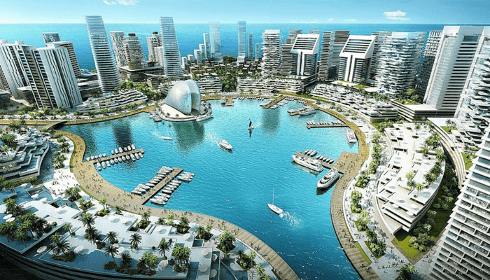
  • Southern Nigeria: This region experiences heavy rainfall, particularly between March and October. Cities like Lagos, Calabar, and Port Harcourt receive some of the highest amounts of rainfall in the country, with annual totals often exceeding 2,000mm.
  • Northern Nigeria: The north receives much less rainfall, with some areas like Sokoto and Kano receiving as little as 500mm annually. The rainy season is shorter here, typically lasting from May to September.
  • Central Nigeria: The middle-belt experiences moderate rainfall, with cities like Abuja receiving between 1,200mm to 1,500mm annually.

How Precipitation Affects Design

Precipitation can affect the design of buildings through the following factors:

  • Stormwater Management: In areas with high rainfall, such as the south, effective stormwater management systems are essential to prevent flooding. The design must include gutters, drains, and retention ponds to direct excess water away from buildings.
  • Roof Design: Roofs in rainy areas should be sloped to allow water to flow off quickly. In contrast, in drier regions, roofs might be flatter to maximize the collection of rainwater for use in the dry season.
  • Flood Resilience: In flood-prone areas, elevated foundations or flood barriers may be required to protect buildings from seasonal flooding. In addition, building materials need to be chosen with water resistance in mind.

Climate-Responsive Strategies for Nigerian Architecture

Given Nigeria’s varying climate zones, architects must adapt design strategies based on temperature, humidity, and precipitation to ensure buildings are comfortable, sustainable, and resilient.

Temperature and Humidity Responsive Design

To design buildings that are responsive to temperature and humidity climatic factors, the following strategies can be adopted:

  • Passive Cooling: In hot and humid areas, the use of thermal mass (materials like stone, brick, or concrete that absorb and release heat) helps regulate indoor temperatures.
  • Landscaping: Using trees, shrubs, and water features strategically around the building can provide natural cooling effects, reduce direct sunlight exposure, and manage humidity levels.
  • Orientation: Building orientation plays a critical role in maximizing or minimizing solar exposure. In tropical and humid regions, buildings should be oriented to catch cool breezes, while minimizing direct sun exposure from the west and east.

Precipitation-Responsive Design

To ensure your designs are precipitation-responsive, the following strategies can be adopted:

  • Water Harvesting: In areas where rain is abundant, like the south, rainwater harvesting systems can be incorporated into the building design to collect and store water for non-potable uses such as irrigation and sanitation.
  • Erosion Control: In flood-prone areas, such as the Niger Delta, elevated foundations, permeable surfaces, and proper drainage systems are essential to control erosion and prevent structural damage.
  • Waterproofing: In areas with significant rainfall, using waterproofing materials for foundations, walls, and roofs is crucial to prevent moisture penetration and damage.

Tools for Climate Analysis

Several tools are used to assess climate factors and assist in designing climate-responsive buildings. Here are a few of them:

  1. Climate Data: Local weather stations and online resources (e.g., WorldClim, Nigerian Meteorological Agency) provide climate data, including temperature, humidity, and precipitation patterns.
  2. Solar Access Analysis: Tools like SolarCalc can help assess the amount of sunlight a building will receive throughout the day, aiding in the design of passive solar systems.

Conclusion

Incorporating climate factors—temperature, humidity, and precipitation—into site analysis is essential for creating buildings that are both comfortable and sustainable in the Nigerian context. By understanding the unique climate conditions of each region and tailoring building designs to suit, architects can ensure that their buildings are resilient to weather extremes, energy-efficient, and suitable for long-term use. Climate-responsive architecture not only improves the quality of life for occupants but also helps to preserve the environment.

Throughout this series, we’ve explored critical aspects like wind, solar orientation, topography, vegetation, climate factors, and site utilities, all tailored to the Nigerian context. It is fair to say that all the aspects involved work hand-in-hand to produce the unique characteristics of every site. By mastering these elements, architects can create climate-resilient, sustainable, and user-focused designs that respond to both the opportunities and challenges of their sites. As you advance in your architectural journey, remember that thoughtful and thorough site analysis not only enhances the quality of your designs but also lays the foundation for a more sustainable built environment. Let every project you undertake reflect this commitment.

Design, Education, Site Analysis Series

Topography and Vegetation: Key to Sustainable Architecture in Nigeria

Introduction

Topography and Vegetation in site analysis are fundamental aspects that shape building designs, influencing everything from structure placement to resource management, aesthetics, and environmental impact. In Nigeria, where diverse climates and landscapes exist across different regions, understanding these factors is essential for creating resilient, context-sensitive architecture.

Understanding Topography in Site Analysis

Topography refers to the physical features of a site’s surface, such as its contours, elevations, slopes, and natural formations. This aspect of site analysis affects not only how a building sits on the land but also its stability, drainage, and overall interaction with the environment.

Natural Formations and Geological Features

Natural formations (e.g., rock outcrops) and geological conditions impact foundation design, construction cost, and stability.

For example, the Jos Plateau, known for granite formations, often requires excavation and reinforcement. Building around or incorporating rock formations can lower construction costs and create unique design features.

In Nigeria’s coastal regions, swampy areas can cause instability. Architects must assess soil type and water levels before building, often recommending pile foundations to anchor buildings securely.

Why Topography Matters in Nigeria

Nigeria’s topography varies significantly:

  • The northern regions are mostly flat or gently rolling plains, with areas like the Jos Plateau introducing higher elevations.
  • The central region contains more undulating terrain, which affects water flow and drainage patterns.
  • The southern region is known for low-lying, swampy areas, particularly in the Niger Delta, where water management is crucial.

This diversity requires site analysis to adapt designs that align with the local terrain for better functionality and durability.

Slope Analysis

Slope is one of the most critical aspects of topography. It affects water drainage, foundation design, and even building access. Slope is generally categorized as gentle (0-5%), moderate (5-10%), or steep (10%+).

Slope Considerations in Nigerian Context

  1. In northern Nigeria, flat terrains are common, making them ideal for expansive layouts.
  2. In hilly areas like Jos Plateau, slope analysis is crucial for stability. Buildings on slopes need specific foundation designs and retaining walls to prevent landslides.
  3. In coastal and delta regions, even a slight slope is beneficial for drainage. However, designs here must address high water tables and flooding risks, which can complicate construction on flat or low-lying land.

How to Measure and Analyze Slope

  1. Surveying Tools: Total stations and drones are valuable for accurate topographic surveys.
  2. Slope Mapping: Use contour maps or digital elevation models to visualize the slope. In Nigeria, GIS data from institutions like the Nigerian Space Research and Development Agency (NASRDA) can help map site contours.
  3. Site Drainage Planning: Use slope data to create a drainage plan. For example, a 5% slope directs water away efficiently, while steeper slopes may require terracing.

Vegetation in Site Analysis

Vegetation involves the types, density, and health of plants, trees, and ground cover on a site. It serves as a natural indicator of soil health, water presence, and sun exposure. Vegetation is important for various reasons. Here are a few reasons:

  1. Climate Buffer: Vegetation reduces heat in hot regions (e.g., northern Nigeria) and adds moisture in drier areas.
  2. Erosion Control: In areas with significant rainfall, such as the Niger Delta, vegetation can prevent soil erosion.
  3. Biodiversity Preservation: Incorporating indigenous plant species preserves local ecosystems, supporting biodiversity and enhancing sustainability.

Vegetation and Microclimate

Vegetation can create microclimates, affecting temperature, humidity, and wind on the site. A microclimate refers to the localized climate of a small, specific area within a larger climate zone. This can be influenced by natural features like vegetation, water bodies, and topography which can affect temperature, humidity, wind patterns, and sun exposure on a site

In savannah regions, which contains some parts of northern Nigeria, trees like baobab and acacia are adapted to dry climates. Retaining or planting similar species offers natural shading and wind breaks.

In rainforest zones, which forms some part of southern Nigeria, dense forests provide high humidity and shade. Clearing these areas for construction should be limited to avoid disturbing the natural moisture balance.

Vegetation Mapping and Analysis

Mapping vegetation types and densities helps determine areas for preservation, replanting, or clearing. For Nigerian projects, it’s vital to recognize indigenous plant species and understand their ecological roles. Mapping and analysis can be carried out using the following:

  1. Aerial Surveys: Using drones or satellite images, architects can map vegetation patterns.
  2. Soil and Vegetation Types: Knowing soil types helps in selecting the right vegetation for replanting or landscaping.
  3. Tree Preservation: Keeping mature trees is beneficial for shading and reducing energy costs. In Nigeria, large trees near structures can help in naturally cooling spaces by blocking direct sunlight.

Integrating Topography and Vegetation into Design

By working with the natural contours and existing plant life, architects can reduce environmental disruption, manage erosion, and improve the building’s resilience to climate conditions. In Nigeria, where diverse terrains and ecosystems are present, adapting the design to respect and utilize natural landforms and vegetation creates buildings that are better suited to their surroundings and require fewer artificial interventions. Here are a few ways for integrating topography and vegetation:

  1. Earthworks and Landscaping: For areas with steep slopes, terracing and retaining walls are effective. These structures stabilize the land and allow vegetation to grow, controlling erosion.
  2. Green Buffers: Vegetative buffers reduce the site’s heat gain. For instance, planting trees on the west side of a building in hot regions of Nigeria shields it from intense afternoon sun.
  3. Natural Water Drainage: Designing with the slope can create natural drainage paths, reducing the need for artificial drainage systems. Vegetation along these paths can absorb water and prevent flooding.

Tools for Topography and Vegetation Analysis

Here are some tools used for topography and vegetation analysis:

  1. GIS and Mapping Software: Tools like ArcGIS allow architects to map topographic and vegetation data.
  2. Total Stations and Drones: Drones equipped with LiDAR can provide accurate 3D topographical maps.
  3. Soil Testing Kits: Knowing soil type and health aids in vegetation selection and assessing foundation requirements.
  4. Climate Data Access: Accessing climate data from Nigerian meteorological agencies provides insights into rainfall, sun patterns, and wind, which influence both topography and vegetation choices.

Conclusion

Incorporating topography and vegetation into site analysis is crucial for creating environmentally responsive and sustainable buildings in Nigeria. Understanding these factors ensures that buildings harmonize with their natural surroundings, reducing environmental impact, enhancing stability, and contributing to energy efficiency.

The next and final post in the series will focus on climate factors in site analysis, which includes understanding temperature, humidity, rainfall, and how these factors influence design strategies in different Nigerian regions.

Design, Education, Site Analysis Series

Assessing Site Utilities and Services: A Guide for Nigerian Architects

Introduction

When planning any architectural project, another critical aspect of site analysis is the assessment of site utilities and services. Utilities and services such as electricity, water supply, waste management, and communication infrastructure are fundamental to the functionality of any building. Without a thorough understanding of how these systems interact with the site, projects can face delays, inefficiencies, and potentially fail to meet the needs of the end-users.

In the Nigerian context, where utility infrastructure varies significantly between urban, semi-urban, and rural areas, conducting a utilities and services assessment during site analysis ensures that the architectural design adapts to these variations. This post will provide an in-depth look at how to assess site utilities and services in Nigeria, focusing on real-world challenges, strategies, and solutions relevant to Nigerian architects.

Importance of Assessing Site Utilities and Services

A comprehensive assessment of utilities and services during site analysis ensures the feasibility and sustainability of a project. It directly affects the building’s operation, cost, and environmental footprint. In the Nigerian context, with its varied levels of infrastructure development, utility services can range from fully reliable in some urban centers to virtually non-existent in more rural areas. This gap makes it vital for architects to plan effectively.

Assessing utilities and services early on helps architects:

  • Design Efficient Systems: By understanding the available utilities, architects can optimize energy and water use, design appropriate waste management systems, and integrate renewable energy solutions where necessary.
  • Avoid Costly Delays: Unanticipated issues such as insufficient power supply or lack of water infrastructure can cause delays and increase project costs.
  • Enhance User Experience: Functional utilities are critical to user comfort and convenience. Whether in residential or commercial spaces, utilities play a significant role in meeting the daily needs of occupants.

Key Utilities and Services to Assess

a. Electricity Supply

One of the most significant utility challenges in Nigeria is the unstable electricity supply. While major cities like Lagos, Abuja, and Port Harcourt have more access to electricity from the national grid, the inconsistency of supply remains an issue. In contrast, many areas in the country rely on local generators or renewable energy sources like solar power.

Key Considerations:

  • Availability and Reliability of Power: During site analysis, it’s essential to evaluate the reliability of the power supply from the national grid. Frequent power outages are common across Nigeria, which makes backup solutions like generators or inverters necessary. In some areas, solar panels can provide a sustainable alternative.
  • On-site Energy Solutions: Where the grid is unreliable or non-existent, consider integrating solar energy systems or hybrid power solutions (solar and generator

b. Water Supply

Water is another crucial utility that often presents challenges in Nigerian construction projects. Urban areas like Lagos and Abuja may have municipal water services, but these systems are often overburdened, and access can be inconsistent. In other regions, architects frequently have to design systems that rely on boreholes or water storage solutions. The use of wells is still very common in rural areas.

Key Considerations:

  • Availability of Municipal Water Supply: In urban areas, architects need to assess the reliability and capacity of the municipal water supply. Water pressure, frequency of supply, and water quality should be analyzed.
  • Borehole and Water Storage Solutions: For areas where municipal water is unavailable or unreliable, boreholes and water storage tanks become essential. Architects need to collaborate with hydro-geologists to determine the feasibility of drilling boreholes, assessing groundwater quality and availability.

c. Sewage and Waste Management

Waste management infrastructure varies widely in Nigeria. In major cities like Lagos, sewage systems exist, but they are often inadequate for large-scale development without additional planning. In rural and semi-urban areas, waste management is even more of a challenge, with many projects relying on septic tanks or composting toilets.

Key Considerations:

  • Connection to Municipal Sewage Systems: In urban centers where sewage systems are available, architects must evaluate the condition of the local sewage systems. If connection to the municipal system is not possible, alternative systems, such as on-site treatment plants or septic tanks, must be considered.
  • Waste Management Solutions: Solid waste disposal is also critical in site analysis. In urban areas, assess the proximity of waste disposal facilities and services. In regions where formal waste collection is unavailable, consider integrating waste segregation and recycling systems into the building’s design.

d. Communication Infrastructure

Reliable communication is essential for both residential and commercial projects. In urban centers, mobile networks and internet access are widespread, but rural areas may lack the infrastructure for consistent service.

Key Considerations:

  • Mobile Network Coverage: During site analysis, verify mobile network coverage. In rural areas, weaker signals may necessitate the installation of signal boosters or satellite-based solutions.
  • Internet and Data Services: For urban projects, internet access is usually available via fiber optic or wireless connections. However, in remote areas, satellite internet may be required.

Challenges in Assessing Site Utilities and Services in Nigeria

a. Unreliable Infrastructure

Nigeria’s utility infrastructure is plagued by inconsistencies. Frequent power cuts, inadequate water supply, and poor waste management systems are some of the biggest challenges faced during site analysis. Architects often need to plan for redundancies, such as backup generators, boreholes, or solar energy, to ensure that the building functions efficiently.

b. Rapid Urbanization and Informal Settlements

In many Nigerian cities, rapid urbanization has led to informal settlements without proper utility services. Architects often need to work around the lack of formal infrastructure by designing off-grid systems for water, energy, and waste management.

c. Cost Constraints

Installing off-grid solutions such as boreholes or solar power systems can significantly increase project costs. However, these solutions are often necessary, especially in certain areas where public utility services are limited or unreliable.

d. Regulatory and Zoning Issues

Regulatory constraints can also complicate utilities assessment in Nigeria. Zoning laws may restrict the types of utilities that can be installed in certain areas, and approval processes can be slow. It’s essential for architects to engage with local authorities early in the site analysis phase to avoid legal complications.

Sustainable Solutions for Utilities and Services in Nigeria

As Nigeria’s energy and utility infrastructure faces strain from population growth and urbanization, architects are increasingly focusing on sustainable solutions to address utility challenges. Here are some approaches:

a. Renewable Energy Integration

Solar energy is a promising solution in Nigeria, particularly in areas with high solar insolation, such as the northern regions. Incorporating solar panels into the design allows buildings to reduce their dependence on the unreliable grid.

b. Rainwater Harvesting

In regions where water supply is inconsistent, rainwater harvesting systems can provide supplementary water. This is especially useful in areas where boreholes may not be feasible due to water table issues.

c. On-site Wastewater Treatment

Instead of relying on inadequate municipal sewage systems, many architects are integrating on-site wastewater treatment plants. These systems process greywater and blackwater, reducing the environmental impact and making buildings more self-sufficient.

d. Smart Utility Management Systems

In commercial developments in Lagos and Abuja, architects are incorporating smart metering and energy management systems to monitor and optimize the use of utilities. This reduces waste, cuts costs, and improves efficiency.

Conclusion

Assessing site utilities and services is a critical aspect of site analysis in Nigerian architecture. From the availability of reliable electricity to water supply and waste management, understanding how these services interact with the site informs every stage of the design process.

In Nigeria, where urban infrastructure is often under strain and rural areas lack access to basic utilities, architects must be innovative, resourceful, and adaptive. By considering sustainable solutions like solar energy, rainwater harvesting, and smart systems, architects can design buildings that are not only functional and resilient but also environmentally responsible.

The next post will focus on topography and vegetation, which plays a critical role in determining how buildings can be adapted to natural landforms, improving drainage, stability, and overall site functionality. Stay tuned!

Design, Education, Site Analysis Series

Understanding the Site Neighborhood: Analyzing Nigerian Neighborhoods for Effective Architectural Planning

Introduction

The relationship between a site and its neighborhood is vital for creating buildings that fit into the context, ensuring harmony with the environment, and the existing social and physical fabric. For architects in Nigeria, a country with diverse urban, suburban, and rural landscapes, mastering the analysis of the site’s neighborhood requires an understanding of the unique characteristics of Nigerian cities, towns, and villages.

In this post, we will discuss the importance of neighborhood analysis in architectural design, highlight key factors to consider, and provide examples relevant to the Nigerian context.

Importance of Neighborhood Analysis in Site Planning

The immediate and extended neighborhood surrounding a site, plays a significant role in influencing the final design. In the Nigerian context, where cities have diverse urban fabrics, neighborhood analysis is even more important to:

  1. Ensure Compatibility: Neighborhood analysis ensures that the new development aligns with existing structures and the community’s character. For example, a modern high-rise building might disrupt the character of a traditionally low-rise neighborhood.
  2. Identify Opportunities for Integration: Understanding the neighborhood allows architects to take advantage of existing infrastructure such as roads, utilities, markets, and public transportation. In fast-growing cities, leveraging proximity to these amenities is critical for sustainable design.
  3. Mitigate Potential Risks: In a rapidly urbanizing country like Nigeria, there may be ongoing changes in land use, zoning, and infrastructure development. By thoroughly understanding the neighborhood, architects can identify potential risks, such as road expansions or changes in land use that might affect the project.

Factors to Consider in Neighborhood Analysis

a. Social and Cultural Context

In Nigeria, a deep understanding of the local culture is crucial in any site neighborhood analysis. Different regions have their own architectural history, social practices, and cultural sensitivities. For example:

  1. Northern Nigeria tends to favor more introverted building layouts due to privacy needs, influenced by Islamic culture. This often leads to courtyard designs.
  2. In Southern Nigeria, especially in the Yoruba region, more communal, outward-facing designs may be prevalent, reflecting the communal nature of the culture.

A failure to respect these cultural norms can lead to a project that feels out of place or is not embraced by the community. An architect working on a residential project in the rural areas of the southwest, for instance, should respect the communal values of the neighborhood and possibly incorporate shared outdoor spaces that foster social interactions.

b. Urban Infrastructure and Transportation

Understanding the neighborhood’s infrastructure is crucial for both the functionality and accessibility of the building. In Nigerian cities, traffic congestion is a major concern, especially in densely populated urban centers like Lagos or Abuja. When conducting site analysis, one must assess:

  1. Road Networks: Are the main access roads adequate? How does the site connect to highways or public transport routes? For example, in Lagos, locating a commercial project near the BRT (Bus Rapid Transit) routes can significantly enhance accessibility.
  2. Pedestrian Movement: In busy cities like Port Harcourt or Kano, understanding pedestrian traffic is also critical, especially in areas close to markets, bus terminals, and business districts. This is vital when planning entrances, exits, and parking areas.
  3. Utilities and Infrastructure: Is there access to electricity, water supply, and sewage systems? In some areas of Nigeria, particularly semi-urban and rural areas, these utilities may be unreliable, and the building design may need to incorporate alternatives such as solar panels or boreholes.

c. Land Use and Zoning

In Nigerian cities, zoning laws may dictate how land within a neighborhood is used. Zoning regulations are typically in place to separate residential, commercial, industrial, and agricultural uses. For example, in certain urban cities like Lagos or Abuja, there are strict zoning laws that dictate land use such as residential houses, commercial developments, mixed-use developments or government use. Ensuring that your building complies with zoning laws prevents potential legal conflicts and ensures the project meets urban development standards.

Moreover, informal land uses, common in developing urban centers like Kano or Ibadan, can complicate zoning adherence. These areas often have unplanned developments where land use is fluid, so architects need to be flexible and ready to adapt designs based on real-world conditions.

d. Environmental Context

The environmental aspects of a neighborhood significantly influence site design in Nigeria. Depending on the region, architects must consider:

  1. Flooding Risks: Coastal regions like Lagos and Port Harcourt are highly prone to flooding. Additionally, areas prone to flooding due to lack of proper drainage should be investigated. Understanding the topography and drainage systems in the surrounding neighborhood is essential to avoid water-logging and foundation damage.
  2. Heat and Sun Exposure: In northern Nigerian cities such as Maiduguri or Kano, where temperatures soar, neighborhood analysis should include the availability of shading from trees or nearby buildings. This helps design with climate-sensitive solutions, like shaded walkways or solar control glazing to reduce heat gain.
  3. Noise Pollution: In areas close to open-air markets like in Onitsha, noise pollution can become a major issue. Identifying noise sources such as traffic, industrial activities, or local markets will help the architect incorporate soundproofing or landscape buffers to enhance the comfort of occupants.

Social and Economic Factors

a. Community Profile and Socioeconomic Factors

In Nigeria, neighborhood’s have widely varying socioeconomic profiles. An architect designing for a high-end neighborhood in Banana Island, Lagos, which may demand luxury materials, higher technology integration, and additional amenities, will approach a project differently than for a lower-income area like Dorayi in Kano, where affordability is prioritized. By understanding the demographics and economic activities of the neighborhood, architects can tailor designs that are both functional and appealing to the local community.

b. Security Considerations

Nigeria’s urban centers vary in terms of safety, and this plays a significant role in neighborhood analysis. In areas where security concerns are prevalent, architects may need to design buildings with security features like perimeter fencing, controlled access, and CCTV surveillance. In more secure and gated communities, the focus may be less on securing the site and more on aesthetics and landscape design.

Neighborhood Character and Architectural Context

a. Architectural Styles

Neighborhood analysis also requires a study of the architectural styles prevalent in the area. Nigerian cities are often a mix of traditional, colonial, and modern architecture. In Ibadan, for example, you will find a blend of old colonial buildings alongside modern office complexes.

It’s essential to maintain a balance between respecting the existing architectural language and introducing contemporary elements. An architect designing in a heritage-rich neighborhood, must consider how the new structure will blend or contrast with the existing architectural heritage.

This image shows a colonial building in Ibadan, Oyo state, Nigeria called Mapo Hall. It shows how the building has elements of classical architecture.
A colonial building- Mapo Hall in Ibadan, Oyo State
(source: https://meetdamilare.com/a-360-interior-and-exterior-look-of-mapo-hall-ibadan-oyo-state/)

b. Building Heights and Density

In fast-growing urban centers, architects must analyze the neighborhood’s building heights and density. If the surrounding buildings are low-rise structures, a high-rise building may feel out of place unless it’s part of a planned high-density urban development.

In Nigeria, particularly in places like Lagos or Port Harcourt, where land is scarce, developments often trend toward high density. The architect’s challenge is to create designs that optimize space without overwhelming the existing neighborhood fabric.

Infrastructure Development Plans and Future Neighborhood Growth

One of the key elements of neighborhood analysis is predicting future growth. Nigerian cities are rapidly urbanizing, and urban plans can change. An area that is currently residential may become commercial or mixed-use in the future due to rezoning or infrastructure developments.

For example, in Ikeja, Lagos, the recent development of the rail line has transformed the neighborhood from a largely residential and light-commercial area to a bustling transport and business hub. Architects must stay informed about infrastructure development plans and urban policies that might influence the site in the coming years.

Case Studies of Neighborhood Analysis in Nigeria

a. Eko Atlantic, Lagos

This is a new city being built on reclaimed land from the Atlantic Ocean. The neighborhood analysis for this project involved not only understanding the surrounding Victoria Island context, but also predicting the future growth of this entirely new area, including transport systems, public amenities, and environmental risks (like sea level rise and erosion).

b. Abuja’s Central Business District (CBD)

In Abuja, the Central Business District’s development was guided by the city’s master plan. Neighborhood analysis here required careful consideration of the proximity to government buildings, hotels, and national monuments. Additionally, as this district is a hub of activity, traffic patterns, parking requirements, and pedestrian flows were key factors in site planning.

Conclusion

Understanding the site’s neighborhood is a vital component of site analysis and plays a defining role in the success of architectural projects. In Nigeria, where regions vary widely in terms of culture, infrastructure, climate, and urbanization, architects must go beyond the site itself to analyze how the surrounding environment impacts design decisions.

In our next post, we will explore site utilities and services, another critical element in site analysis, which plays a significant role in building services. Stay tuned!

Design, Education, Site Analysis Series

Solar Orientation and Its Impact: Mastering Solar Orientation for Sustainable Architecture in Nigeria

Introduction

As architects navigating the diverse landscape of Nigeria, understanding the aspects of solar orientation is vital for creating buildings that seamlessly integrate with our environment. In this comprehensive guide, we will explore the significance of solar orientation, its impact on energy efficiency, and practical strategies tailored to the Nigerian context.

Importance of Solar Orientation

The sun is such a powerful element that can dictate the design of buildings. The sun affects the temperature, visibility, energy consumption, material degradation, solar gains, indoor air quality, and overall, the psychological and physical well-being of the users. This makes it vital to understand how to use the sun to your advantage as an architect.

In the Nigerian climate, characterized by varying temperatures and abundant sunlight, optimizing solar orientation is a game-changer. In an environment like Nigeria where we feel the impact of global warming, rising temperatures and the lack of stable electricity to even depend on artificial cooling systems, proper solar orientation not only enhances natural lighting but also influences passive heating and cooling, significantly impacting the overall energy performance of a building.

Given these factors, it is clear that mastering solar orientation is crucial for architects in Nigeria. By strategically positioning buildings and selecting appropriate building materials, architects can harness the benefits of the sun while mitigating its challenges. This approach not only promotes energy efficiency but also enhances the comfort and sustainability of living and working spaces.

Solar Path in Nigeria

a. Equatorial Location

Nigeria’s equatorial position ensures a consistent solar path throughout the year. Nigeria is located slightly above the equator. While the equator is at 0 degrees latitude, Nigeria is approximately within the latitudes 4 degrees to 14 degrees North and longitude 3 degrees to 15 degrees West. This means the country experiences a tropical climate with significant solar exposure throughout the year. Understanding the sun’s trajectory is crucial for architects aiming to harness its energy effectively.

The diagram shows the equatorial location of Nigeria which  is approximately within the latitudes 4 degrees to 14 degrees North and longitude 3 degrees to 15 degrees West.
Equatorial Location of Nigeria

b. Seasonal Variations

Although Nigeria does not experience the typical seasonal variations (spring, summer, autumn, and winter) due to its tropical nature, subtle shifts in the sun’s path occur, influencing daylight availability and the angle of incidence. Nigeria experiences two seasons; dry and wet seasons. The dry season is typically from November to March while the wet season is from April to October.

c. Solar Path Changes

The sun’s path varies throughout the year affecting its altitude and the angle in which it strikes the Earth. This variation is commonly known as Summer Sun and Winter Sun. Even though Nigeria does not have a summer or winter, the concept still applies in terms of solar path change. During the “summer” months (roughly June to September), the sun is higher in the sky leading to more direct and intense sunlight. During “winter” months (roughly December to February), the sun’s path is lower resulting in less direct sunlight.

The diagram shows the variations of the sun angle during different times of the year. The summer sun is higher during hot seasons while the winter sun is lower during dry or cold seasons.
Sun Angle Variations

Tools for Solar Analysis

a. Sun Path Diagrams

Sun path diagrams visually represent the sun’s movement throughout the day and across seasons. These tools can aid in understanding the variations in solar exposure at different times of the year.

This diagram is showing an example of a sun path diagram of Lucknow
Sun path diagram of Lucknow
(Source: www.jaloxa.eu/resources/daylighting/docs/sunpath_27_north.pdf) 

b. Solar Analysis Software

Advanced software allows for simulations and analysis of solar exposure based on specific geographical locations. This technology enables precise calculations for optimal solar orientation.

Site-Specific Considerations

a. Topography

The surrounding topography plays a crucial role in solar orientation. Analyzing hills, slopes, and adjacent structures helps architects determine potential shading and exposure patterns.

This diagram is showing how topography can affect the relationship between the sun and buildings. The example in the diagram is showing how a hill is blocking the sun from buildings located at the base of the hill.
Effect of Topography on Sun Path

b. Vegetation

Trees and foliage impact solar exposure. Integrating landscaping strategically can provide shade in areas prone to excessive sunlight while ensuring optimal exposure where needed.

This diagram is showing how vegetation can affect the relationship between the sun and buildings. The example in the diagram is showing how tall trees are blocking the sun from buildings located behind the trees.
Effects of Vegetation on Sun Path

c. Existing Buildings

Existing buildings can cast shadows that affect the amount of sunlight reaching a proposed building depending on their height and orientation. This can impact solar access, natural lighting and opportunities for installing solar panels.

This diagram is showing how existing buildings can affect the relationship between the sun and other buildings. The example is the diagram is showing how a tall building is blocking the sun from smaller buildings located behind it.
Effects of Existing Buildings on Sun Path

Design Strategies for Solar Orientation

a. Building Orientation

Placing the building along an east-west axis reduces excessive heat gain from the low-angle morning and afternoon sun. Additionally, in the Northern Hemisphere, orienting the building with the longest side facing south maximizes solar gain in winter (dry season) and minimizes it in the summer (hot season).

This diagram is showing the ideal building orientation for solar optimization. Placing the building along an east-west axis reduces excessive heat gain from the low-angle morning and afternoon sun.
Ideal Building Orientation for Solar Optimization

b. Fenestration Designs

Strategically placing windows, incorporating shading devices, and utilizing high-performance glazing enhances day-lighting while minimizing solar heat gain. It is also important to optimize wall-to-window ratio to maximize natural light while minimizing heat gain or loss.

c. Building Material Selection

Using light-colored or reflective materials on roofs and walls can reduce heat absorption. Also, incorporating materials with high thermal mass like thick concrete or brick walls can help insulate the building and improve indoor comfort.

d. Landscaping

Planting deciduous trees can help provide shade and help with cooling around the building. Incorporating vegetation on roof and walls can significantly reduce heat absorption and improve insulation.

This diagram is showing how the use of fenestration design and landscaping can enhance solar optimization in buildings. The diagrams shows how overhangs can be used as shading devices to protect the building from solar heat gain. It also shows how trees can be used to provide shade and serve as a barrier against the sun.
Use of Fenestration Design and Landscaping for Solar Optimization

Case Studies

a. Residential Design – Passive Solar Heating

In the northern region, architects can design homes with south-facing windows to capture sunlight during the day, providing natural warmth during cooler evenings.

b. Commercial Building – Daylight Harvesting

In a bustling urban area, a commercial complex incorporating skylights and reflective surfaces can maximize natural daylight, reducing the need for artificial lighting.

Sustainable Design Integration

Optimizing solar orientation aligns seamlessly with sustainable design principles, offering the following benefits:

a. Energy Efficiency

Proper solar orientation reduces reliance on artificial heating and cooling systems, contributing to energy efficiency and lower operational costs.

b. Daylight Benefits

Maximizing natural light improves indoor comfort, reduces the need for artificial lighting, and positively impacts occupants’ well-being.

c. Renewable energy

Proper positioning of solar panels to maximize exposure to sunlight can significantly improve clean energy generation. Innovations like Building-Integrated Photovoltaic (BIPV) which allows for solar panels to be integrated into building materials like facades or windows are a great way to enhance energy efficiency and aesthetic appeal.

Challenges and Solutions

Navigating solar orientation presents challenges, but architects can overcome them with thoughtful solutions:

a. Shading Strategies

Strategic placement of shading elements, such as overhangs and louvers, mitigates issues related to excessive solar exposure.

b. Urban Planning Considerations

In densely populated urban areas, architects must consider the collective impact of building orientations on the local micro-climate and energy demand.

Conclusion

Solar orientation stands as a cornerstone in the architectural dialogue of Nigeria. By unlocking the potential of the sun, architects can create buildings that not only respond to the climate but also contribute to energy efficiency and sustainable living. As we continue our exploration of architectural considerations and the importance of proper site analysis in Nigeria, the role of solar orientation demonstrates the synergy between design and the natural environment.

In our next post, we will explore the effects of neighborhoods on a building site in architecture, continuing our journey toward creating spaces that seamlessly integrate with their environment. Stay tuned for more insights and practical tips on architectural design!

Design, Education, Site Analysis Series

Wind in Site Analysis: A Guide to Wind Analysis in Nigerian Architecture

Introduction

As architects, we embark on a journey to design spaces that not only captivate the eye but also resonate with functionality and sustainability. One critical aspect of this journey involves understanding and incorporating wind analysis into our design process. Nigeria’s varied climate zones, spanning from tropical to arid, present unique challenges and opportunities. In this guide, we will delve into the intricacies of wind analysis, exploring its importance, tools employed, site-specific considerations, and real-world case studies.

Importance of Wind Analysis

Before we dive into wind analysis, it is necessary to understand climate. Climate is the long-term pattern of weather conditions of an area tracked over a period of at least 30 years. It can be divided into two categories which are macro-climate and micro-climate.  Macro-climate involves the weather conditions that are formed by global patterns, while micro-climate involves weather conditions when a global weather pattern meets a local condition i.e., topography, natural or man-made physical features.

In understanding the importance of wind, it is important to understand that two categories of winds can be present on any site. These are winds formed by macro and micro-climates. The macro-climate in relation to wind gives us the prevailing winds in an area, while the micro-climate provided us with local winds caused by either natural (vegetation, topography) or man-made (existing buildings) features of a site.

Wind analysis is the basis in the creation of buildings that seamlessly blend aesthetics with functionality. In Nigeria, where the weather varies a lot from various regions, using the wind’s power in designs becomes really important. By conducting a thorough wind analysis, architects can optimize natural ventilation, passive cooling, and overall energy efficiency.

Types of Prevailing Winds in Nigeria

a.      North-East Trade Wind

The North-East Trade Wind also known as the Tropical Continental Airmass is the wind which blows from across the Sahara Desert through Niger republic to Nigeria from the north-eastern part of the country. It is a cold dry and dusty wind that causes dry and dusty weather and it blows between November to February which makes up the harmattan period.

b.      South-West Trade Wind

The South-West Trade Wind also known as the Tropical Maritime Airmass is the wind which blows from across the Atlantic Ocean to the southern coast of Nigeria through the south-western part of the country. It is warm and moist air that normally blows between March to November which makes up the rainy season.

Site-Specific Considerations

This helps us understand the micro-climate of a site. To truly grasp the influence of wind on a site, architects must consider the specific characteristics of the location:

a. Topography

The surrounding topography can significantly affect wind patterns. Analyzing hills, valleys, and open landscapes provides valuable insights into potential wind channels and windy areas.

Graphic illustration displaying the impact of wind on buildings situated at various topographical levels. The image visually conveys how structures are influenced by wind forces across different elevations, offering insights into the relationship between building placement and wind effects for educational or analytical purposes.
Effects of Topography on Wind Pattern

b. Surrounding Buildings

Adjacent structures can either obstruct or enhance airflow. Evaluating nearby buildings helps architects design structures that work in harmony with the existing environment.

Graphic representation demonstrating the influence of surrounding buildings on wind patterns. The image visually conveys the way structures can alter the flow of wind, showcasing the effects of building placement on local wind patterns. This illustration is designed to aid understanding of how the built environment can impact wind dynamics for educational or planning purposes.
Effects of Surrounding Buildings on Wind Pattern

c. Vegetation

Trees and other vegetation impact wind patterns. Integrating landscaping elements strategically can both harness and buffer the wind, contributing to a comfortable microclimate.

Graphic illustration depicting the influence of surrounding vegetation on wind patterns around buildings. The image visually communicates how various types of plants can impact and modify the flow of wind, highlighting the role of vegetation in shaping local wind dynamics. This illustration is designed for educational purposes to illustrate the interaction between buildings and surrounding greenery in affecting wind patterns.
Effects of Vegetation on Wind Pattern

Design Considerations

a. Building Orientation

Optimal building orientation is key to maximizing or mitigating prevailing winds. A thoughtful approach ensures that structures work in tandem with the environment, enhancing natural ventilation and passive cooling.

b. Form and Facade Design

Architects must consider building shapes that minimize wind resistance, especially in areas prone to strong winds. Façade designs should prioritize controlled ventilation and even wind pressure distribution.

Tools for Wind Analysis

For architects navigating the complexities of wind patterns, several tools prove invaluable:

a.      Anemometers

These instruments measure wind speed, providing crucial data for understanding the force and potential impact of wind on a building.

b.      Wind Vanes

Determining wind direction is essential for designing structures that respond effectively to prevailing winds. Wind vanes help architects make informed decisions about building orientation.

c.       Wind Rose Diagrams

Wind rose diagrams provide a clear visualization of wind patterns, showcasing the frequency and direction of prevailing winds over time. These diagrams are instrumental in understanding the dominant wind directions and planning accordingly.

d.      Computational Fluid Dynamics (CFD) Simulations

Advanced simulations allow architects to visualize and analyze wind patterns in a digital environment. This aids in predicting airflow, pressure differentials, and potential areas of concern.

Case Studies

Lets take a look at how architects successfully integrated wind-responsive designs in various Nigerian climate zones:

a. Tropical Climate – Courtyards for Natural Ventilation

In tropical regions, architects leverage courtyards to facilitate natural ventilation while maintaining privacy. These open spaces create a cooling effect, enhancing the overall comfort of the occupants.

b. Arid Climate – Aerodynamic Building Shapes

In arid regions, where wind loads can be substantial, architects employ aerodynamic building shapes to minimize resistance. This not only improves the building’s resilience but also enhances its energy efficiency.

Sustainable Design Integration

Wind analysis aligns seamlessly with sustainable design principles, offering architects the following benefits:

a. Reduced Reliance on Mechanical Ventilation

By designing with natural ventilation in mind, architects can reduce dependence on mechanical systems, contributing to energy efficiency and sustainability.

b. Enhanced Occupant Comfort

Balancing wind analysis with design considerations results in spaces that prioritize occupant comfort without excessive energy consumption.

Graphic illustration demonstrating the use of dense tree planting to deflect and channel wind into a house for optimal ventilation. The image visually conveys how strategically placed trees can influence and redirect the flow of wind, promoting effective ventilation within the house. This illustration is designed to showcase the concept of using landscaping for sustainable and natural ventilation strategies for educational or design purposes.
Strategies for Integrating Wind into Sustainable Designs

Challenges and Solutions

Navigating wind analysis presents challenges, but architects armed with knowledge can overcome them:

a. Strong Winds in Open Landscapes

Strategically placing windbreaks and using site features to channel and buffer wind can mitigate the challenges posed by gusty winds in open landscapes.

b. Balancing Natural Ventilation with Privacy

In dense urban environments, architects face the challenge of balancing the desire for natural ventilation with the need for privacy. Innovative façade designs and landscaping can provide effective solutions.

Conclusion

Wind analysis stands as a pivotal component of site analysis in architecture, especially in a diverse country like Nigeria. By understanding and harnessing local wind patterns, architects can create structures that not only withstand environmental challenges but thrive in harmony with the elements. As aspiring architects, embracing the intricacies of wind analysis sets the stage for designs that are not only visually captivating but also sustainable and resilient.

In our next post, we will explore the role of solar analysis in architecture, continuing our journey toward creating spaces that seamlessly integrate with their environment. Stay tuned for more insights and practical tips on architectural design!

Design, Education, Site Analysis Series

Site Analysis Series

Welcome to the launch of an exciting new series – the Site Analysis Series. This series is meticulously crafted to delve into the intricacies of site analysis in architecture. As we embark on this journey, we will unravel the layers of information essential for shaping architectural designs that seamlessly integrate with their surroundings.

As previously discussed in our Preliminary Design Stage Series, site analysis is an important aspect in design and planning as it exposes the opportunities and limitations of a proposed site which affects the overall outcome of a building. This makes it necessary to fully investigate the features on and off the site. The purpose of this series is to learn about the site features in a more in-depth manner.

Throughout the upcoming episodes in this series, we will explore the following components of site analysis, each playing a crucial role in the prelude to architectural design:

  1. Wind in Site Analysis
  2. Solar Orientation and Its Impact
  3. Understanding the Site Neighborhood
  4. Site Utilities and Services Assessment
  5. Topography and Vegetation: Nature’s Blueprint
  6. Climate Factors: Temperature, Humidity, and Precipitation

Stay engaged as we navigate through the diverse facets of site analysis, providing you with insights into how these components influence architectural decisions and design outcomes.

Feel free to share your expectations for this series in the comments below. If you’re a student or a design enthusiast, have you ever engaged in site analysis? What aspects do you find intriguing or challenging?

Your feedback is invaluable; drop your comments or reach out via email with any suggestions. Engage, learn, and let’s create architecture that resonates with the environment!

Site analysis in architecture is an enriching journey. Though it may pose challenges, the profound understanding gained is worth the effort. Stay tuned for the first episode coming soon.

Architectural Working Drawing Series, Design, Education

Episode 8: Schedules and Specification Writing

In the world of working drawings, schedules and specification writing are structured methods for the presentation of comprehensive notes or details of materials, architectural components (such as doors and windows), and various equipment within a drawing. These are typical organized in tabular form and are often accompanied by pictorial schedules for additional clarity. The primary objective behind integrating schedules into a compilation of construction documents is to communicate clearly regarding the location, dimensions, materials, and specifications of doors, windows, roofing materials, equipment, plumbing, electrical fixtures and other building components.

The careful execution of schedules serves a crucial role in preventing drawings from becoming too crowded by excessive textual information or annotations. Schedules benefit not only the drafter but also prove instrumental for architects, engineers, contractors, and on-site personnel. Schedules provide information on the product name, model number, size, quantity, rough opening size, material, color or finish of building components.

This post is designed to provide insights into the interpreting of tabulated information present on working drawings. It is important to know that schedules and specifications provide explicit details pertaining to building elements, whereas drawings provide the dimensions, location and placement of the elements in question.

Types of Schedules in Construction

Schedules are not only used by architects. They are produced by structural engineers, mechanical and electrical engineers, and contractors. Schedules are generally organized in a drawing set such that they are near the discipline to which they are related. Here are some types of schedules produced as part of construction documents:

  1. Door Schedules
  2. Window Schedules
  3. Finishing Schedules (wall, floor and ceiling finish)
  4. Lightning Fixture Schedules
  5. Electrical Fixture Schedules
  6. HVAC Schedules
  7. Plumbing Schedules
  8. Furniture Schedules

The list does not stop there, as schedules can be produced for almost every building component e.g., roof, lintels, columns, beams, appliances, etc. In summary, schedules serve as a vital part of drawings as they give a breakdown of all necessary elements in construction.

As an architect, there are certain schedules which fall under your line of work. The major types are door schedules, window schedules, and finishing schedules. However, you may also do other schedules for relatively smaller projects. Let’s take a look at the major type of schedules.

Door Schedules

Door schedules typically indicate the tag number, model, quantity, size, thickness, type, material, function, frame material, fire rating, and remarks. Sometimes tabulated door schedules are accompanied by graphical representations in pictorial form with floor plan views and elevational views of the door to facilitate identification. Door schedules may include information regarding glazing and louvers if appropriate.

Example of Door Schedule

Window Schedules

Similar to a door schedule, a window schedule provides an organized presentation of the relevant window features. The pictorial form of the window in the schedule should provide information on the fixed and operational parts of the window and indicating the hinge location. Window schedules provides information of the tag number, quantity, type, model, manufacturer, size, rough opening, materials, glazing, and finish. An additional column for remarks/notes can be added to the table.

Example of Window Schedule

Finishing Schedule

A finishing schedule specifies the interior finishing for each space in the building. The schedule provides information for the wall finish, floor finish, and ceiling finish. The finishing schedule should account for every space in a building including entry ways, hallways, etc. In finishing schedules, it is necessary to assign a room number to every space. This is usually done with a number system. An example is “101”. The first “1” indicates the floor level, which starts from the ground floor, while “01” indicates the number of the space.

Example of Finishing Schedule

In assigning wall finishing, certain projects may have different wall finishing within the same space. To cater for this, each wall is divided to north, south, east and west wall.

Schedules and specifications play a crucial role. These organized tables are not just about preventing clutter; they are tools for effective communication. Each schedule tells a unique story, detailing materials and dimensions. Remember, schedules go beyond doors and windows; they touch every aspect of construction, guiding the building’s creation. So, embrace the simplicity of tables, turning architectural drawings into harmonious structures that stand the test of time. In these details, you find the true artistry of architectural creation.